


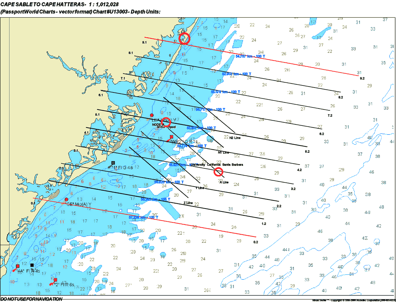
30 Meter AM Flight Lines
(Click on thumbnail for full image)
Station and Turn Times
| Line |
Line Begins
|
Line Ends
|
Zenith Angle
|
Turn Time
|
Direction
|
| Line 6 |
8:59 AM
|
9:04 AM
|
55.8
|
6 minutes
|
E-W
|
| Line 8 |
9:10 AM
|
9:15 AM
|
53.52
|
8 minutes
|
W-E
|
| Line 7 |
9:23 AM
|
9:28 AM
|
51.03
|
6 minutes
|
E-W
|
| Line 5 |
9:34 AM
|
9:39 AM
|
48.93
|
6 minutes
|
W-E
|
| Line 3 |
9:45 AM
|
9:50 AM
|
46.84
|
6 minutes
|
E-W
|
| Line 1 |
9:56 AM
|
10:01 AM
|
44.77
|
7 minutes
|
W-E
|
| Line 2 |
10:08 AM
|
10:13 AM
|
42.53
|
6 minutes
|
E-W
|
| Line 4 |
10:18 AM
|
10:23 AM
|
40.69
|
W-E
|
If time permits, Line 0 and Line 9 will be flown after the 8 original lines.
Latitude and Longitude Points
| Line |
Point
|
Latitude
|
Longitude
|
| Line 0 |
0.1
|
39 16.947 N
|
74 37.764 W
|
|
0.2
|
39 11.598 N
|
73 58.462 W
|
|
| Line 1 |
1.1
|
39 19.318 N
|
74 34.949 W
|
|
1.2
|
39 14.108 N
|
73 57.007 W
|
|
| Line 2 |
2.1
|
39 21.739 N
|
74 32.809 W
|
|
2.2
|
39 16.524 N
|
73 54.362 W
|
|
| Line 3 |
3.1
|
39 24.144 N
|
74 30.271 W
|
|
3.2
|
39 18.912 N
|
73 51.809 W
|
|
| Line 4 |
4.1
|
39 26.642 N
|
74 28.385 W
|
|
4.2
|
39 21.521 N
|
73 50.688 W
|
|
| Line 5 |
5.1
|
39 29.114 N
|
74 26.410 W
|
|
5.2
|
39 24.032 N
|
73 49.369 W
|
|
| Line 6 |
6.1
|
39 31.787 N
|
74 25.848 W
|
|
6.2
|
39 26.456 N
|
73 46.773 W
|
|
| Line 7 |
7.1
|
39 34.032 N
|
74 21.921 W
|
|
7.2
|
39 28.984 N
|
73 45.346 W
|
|
| Line 8 |
8.1
|
39 36.470 N
|
74 19.915 W
|
|
8.2
|
39 31.480 N
|
73 43.430 W
|
|
| Line 9 |
9.1
|
39 38.999 N
|
74 18.078 W
|
|
9.2
|
39 33.752 N
|
73 40.290 W
|