July 31, 2001 NOAA Shoreline Dataset
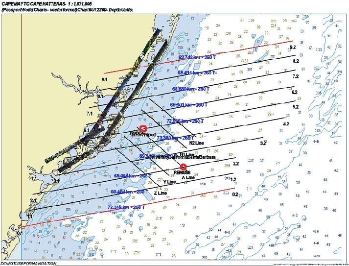
Below is an imagemap which provides a closer look at the images collected for each individual line. Click on any line to view a larger, more detailed image of the run. The log of the flight will be posted here shortly.