


FSLE Communication
(Click on an image for a higher resolution version.)
Flight 11/05/00
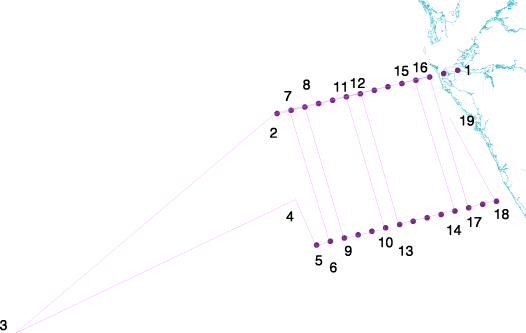
We flew lines 1-14 on the 3rd and 5th. Maps and summaries will be placed on web server tomorrow. Today's flight had good communications with the R/V Pelican, with simultaneous collection of slow drop IOP and AOP package, surface Rrs, and aircraft over flight.
Schedule for the 7th includes deep water calibration, line 15.
The 7th and 9th also offer the possibility of concurrent flights with the NASA Airborne Oceanographic LIDAR (http://aol.wff.nasa.gov/aolfl_pub.html) data system being flown on the NOAA Twin Otter. Details to follow in the next posting.
Flight 11/06/00
The following attachment is the anticipated flight lines for Nov. 7th of the NASA AOL/NOAA Twin Otter system. We are going to coordinate our 1030 EST lines to fly over the R/V Pelican for in-water IOP, AOP, and Rrs measurements. We are anticipating an additional cooperative flight on Nov. 8th to map onshore-offshore CDOM and frontal boundaries outbound from Charlotte Harbor and Tampa Bay, as well as coordination of the standard FSLE schedule on Nov. 9th. Cool stuff!
Flight 11/08/00
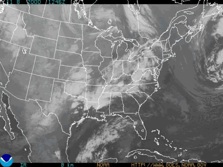
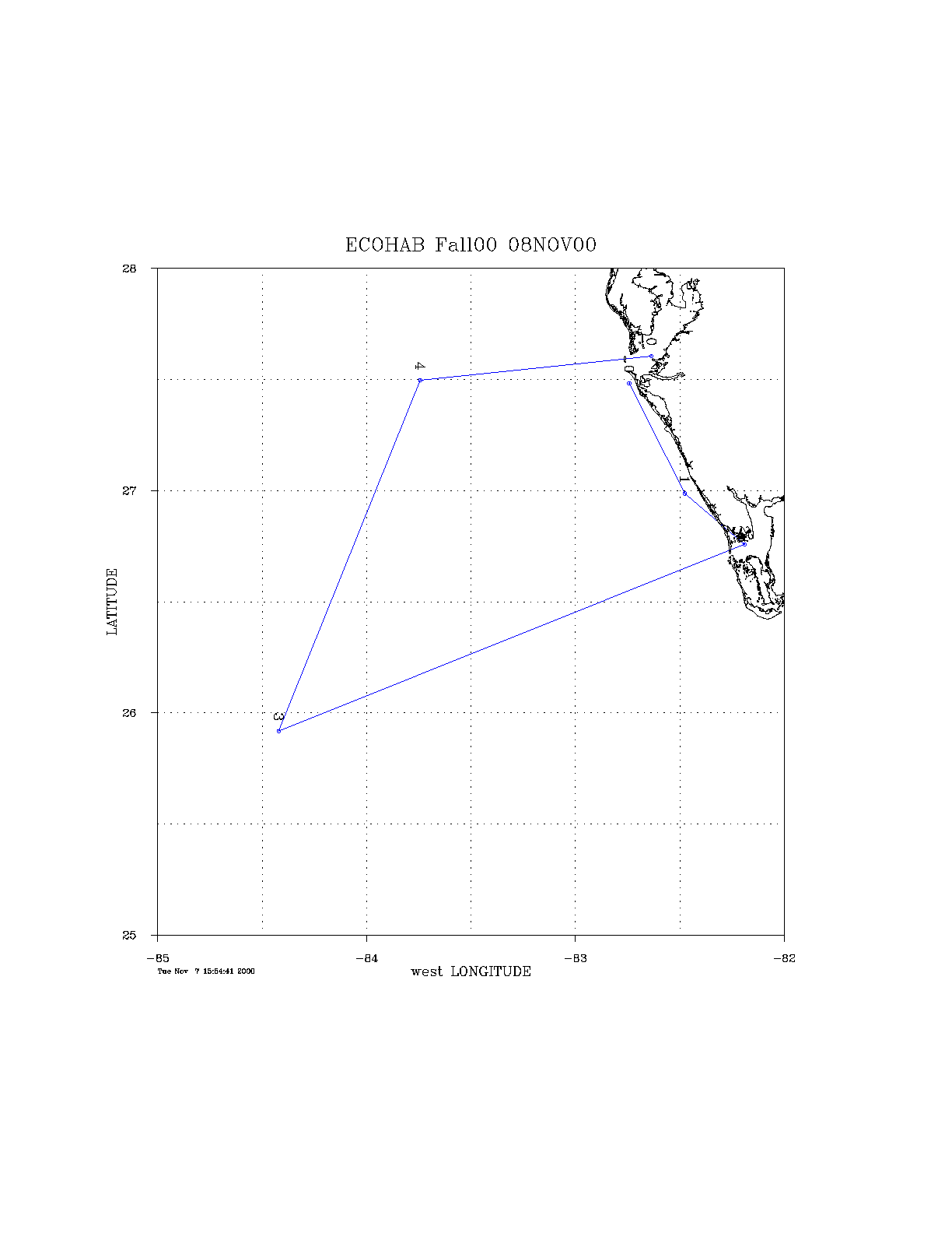
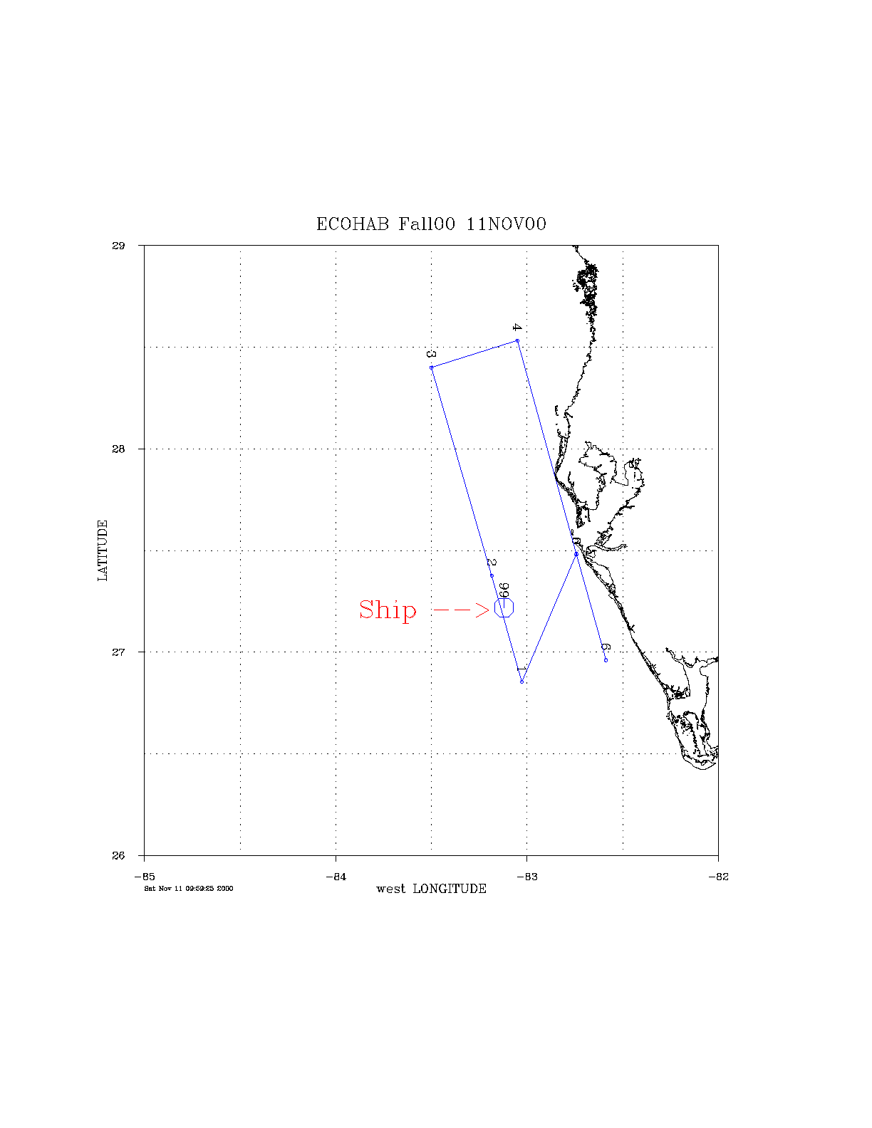
Today's (Nov. 8th) cross shelf flights scheduled with the NASA/NOAA AOL team has been scrubbed because of clouds (see attached PPT document with NOAA GOES 8 IR image). It has been rescheduled for Friday (See attached GIF image for anticipated flight plan).
Yesterday's (Nov. 7th) flight collected 12 of the 14 lines. Lines 12 and 14 were not collected because of cloud cover. However, the visibility was better than had been over the rest of the area and we were able to concurrently collect data with the RV Pelican and the NASA/NOAA AOL team.
Tomorrow's (Nov. 9th) will be our standard collection runs, as well as the deep water calibration site on line 15. We will again be coordinating our collections with the NASA/NOAA AOL flights.
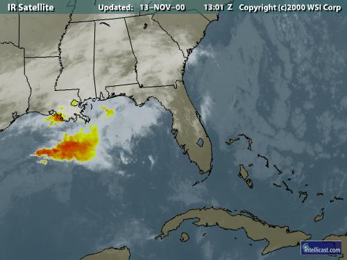
Flight 11/09/00
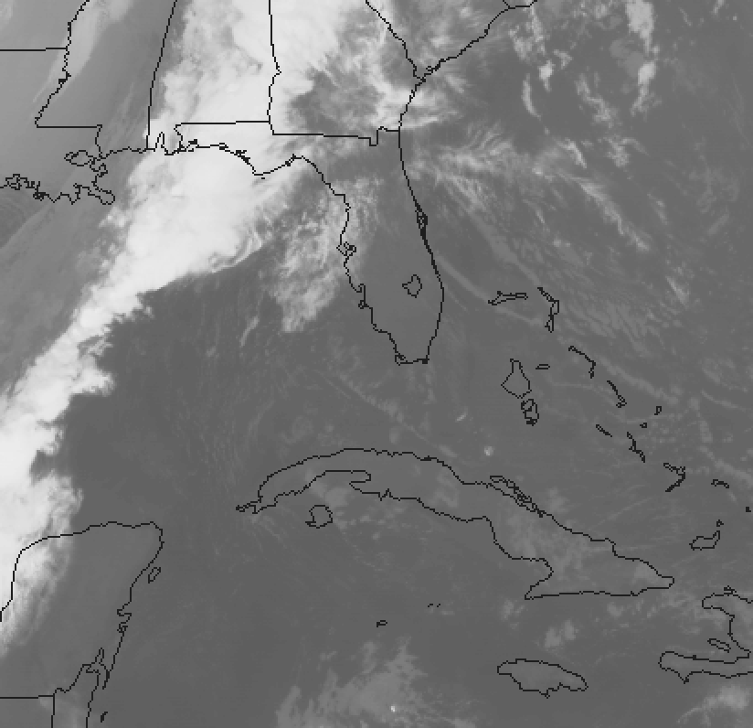
Bad news - overcast with a cold front coming to visit (See attached). Bad day for remote sensing. Good news is that a cold front is coming and by saturday/sunday we should have spectacular conditions.
Bob Swift and Mary Culver of the NASA/NOAA AOL group are attempting to reschedule their aircraft to fly this weekend.
Flight 11/10/00
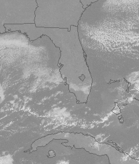
We scrubbed today's flight (see attached HIRES_vis_0857EST.jpg). Tomorrow's possibility looks excellent. NASA/NOAA team was able to reschedule for the weekend (see attached fl_111100.gif). The last NASA/NOAA line may change if we do not do the deep water calibration site.
As the weather appears to be clearing, we planned to fly Nov. 11, 12, and 13.
Flight 11/11/00
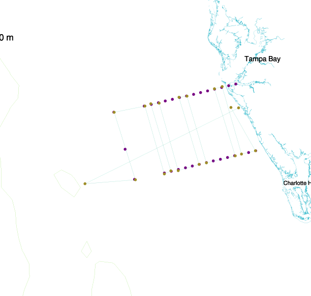
Clouds covered much of our study area, so the FERI and NASA/NOAA flight teams made a modified flight plan to collect as much concurrent data before the end of NASA/NOAA AOL experiment. See attachments for cloud cover and new flight plan.
Flight 11/12/00
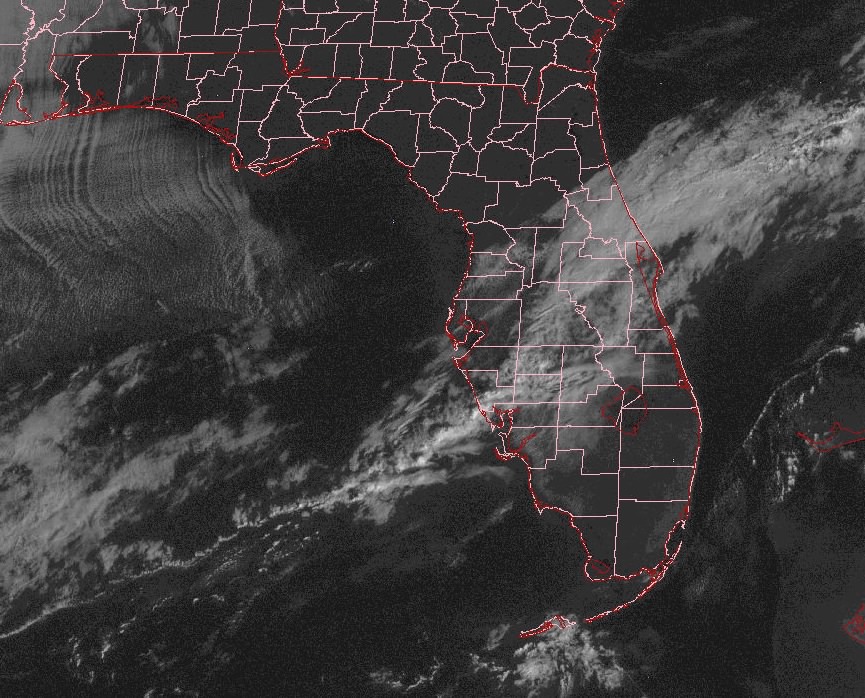
We flew 10 of 14 lines on Nov. 12; cirrus clouds came in to cover the lines we were not able to fly. Today's flight was cancelled because of approaching cold front (see attached) and cloud cover. We do not anticipate the cold front to be cleared of the survey area by tomorrow, so our flight operations to support the FSLE experiment are probably over. We will check the weather tomorrow on the off chance the front clears the area and will fly if clear. Nov. 15th is scheduled for calibration work and low altitude studies.
[Back] to FSLE November Home